
Lakes in Slovenia
6 of 30Lake Bled
Why go
A lake in the Julian Alps beside the town of Bled, a tourist destination just 35 km from Ljubljana International Airport. Wikipedia
Getting there
DirectionsLake Jasna
Why go
Two interconnected artificial lakes near Kranjska Gora on the road to the Vršič Pass, arranged for tourism where the Mala and Velika Pišnica meet. Wikipedia
Getting there
DirectionsWild Lake
Why go
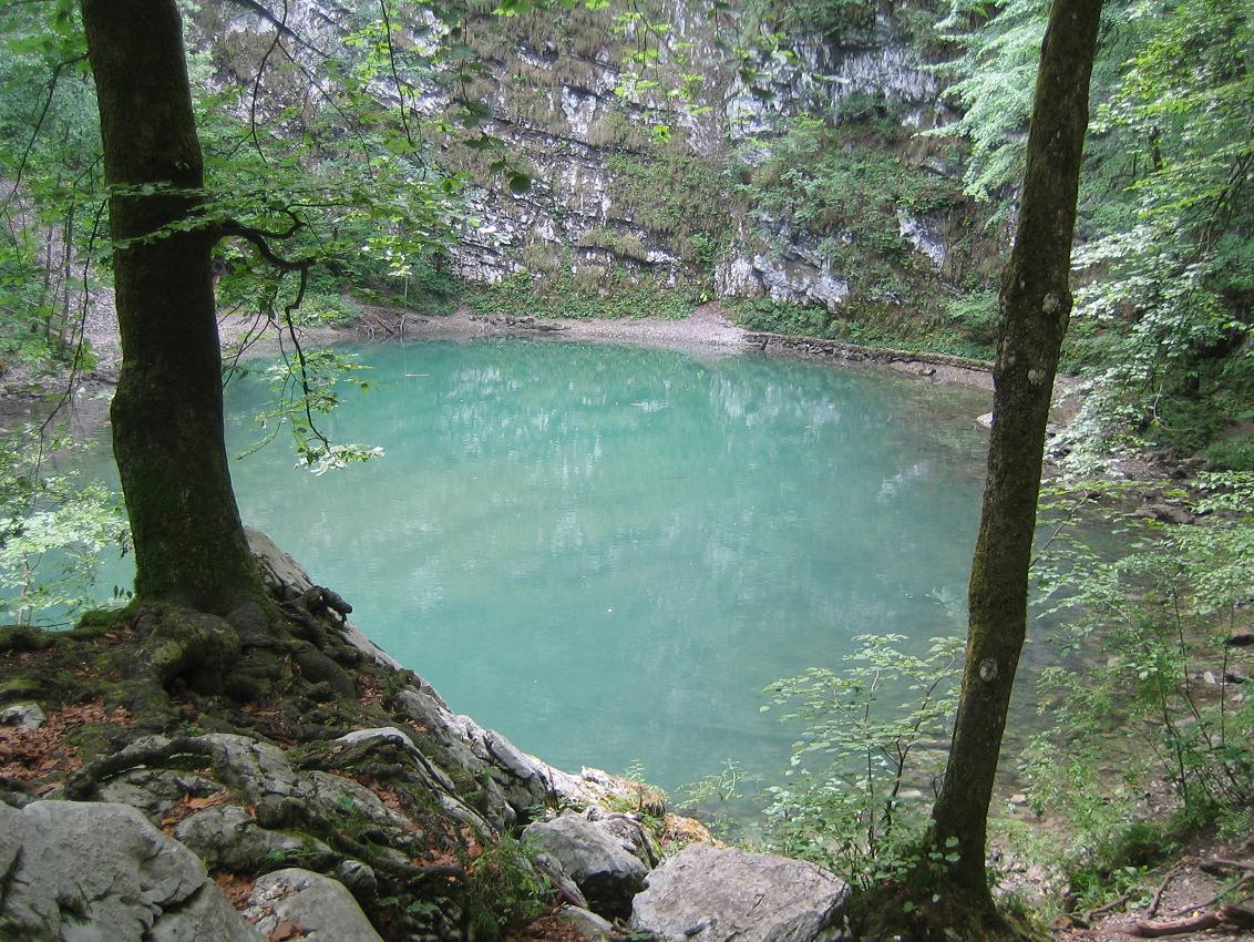
A karst spring near Idrija whose water, flowing from a submerged cave, feeds the Jezernica, at 55 metres the shortest river in Slovenia. Wikipedia
Getting there
DirectionsLake Cerknica
Why go
An intermittent lake in the karst Cerknica Polje of Inner Carniola, southwestern Slovenia. Wikipedia
Getting there
DirectionsLake Bohinj
Why go
Slovenia's largest permanent lake, covering 318 hectares in the Bohinj Valley within Triglav National Park. Wikipedia
Getting there
DirectionsLake Kreda
Why go
A man-made lake in the Radovna Valley that filled a basin dug out while chalk was mined there until 1985. Wikipedia
Getting there
Directions- +24 more on the full mapEvery one pinned with a note in the Lakes layer.




Hikes & Trails in Slovenia
2 of 27Šmarna gora
Why go
A Ljubljana district named after Mount Saint Mary, an inselberg in the north of the Slovenian capital. Wikipedia
Getting there
Directions- Hikes & Trails
Logar Valley
Why go
A valley in the Kamnik Alps, protected since 1987 as a landscape park covering 24.75 square kilometres. Wikipedia
Getting there
Directions - +25 more on the full mapEvery one pinned with a note in the Hikes & Trails layer.

This guide shows 15. The map has 142.
Every place in this guide plus 127 more, colour-coded by layer and ready to navigate in Google Maps.
Viewpoints in Slovenia
1 of 26- Viewpoints
Lake Bled Viewpoint
Why go
A vantage point over Lake Bled, the Julian Alps lake adjoining the town of Bled, about 55 km from the capital, Ljubljana. Wikipedia
Getting there
Directions - +25 more on the full mapEvery one pinned with a note in the Viewpoints layer.
Caves & Gorges in Slovenia
6 of 29Postojna Cave
Why go
A 24.34 km karst cave system created by the Pivka River, the second-longest in Slovenia and one of its top tourism sites. Wikipedia
Getting there
DirectionsSkocjan Caves
Why go
A significant cave system on the Karst Plateau, included on UNESCO's World Heritage list in 1986. Wikipedia
Getting there
DirectionsPredjama Castle
Why go
A Renaissance castle built within a cave mouth in Inner Carniola, about 9 kilometres from Postojna Cave. Wikipedia
Getting there
DirectionsWeaver Cave
Why go
A 2,885-metre ponor cave traversed by Rak Creek, running from the Rak Škocjan Valley into Planina Cave. Wikipedia
Getting there
DirectionsKrka Cave
Why go
A horizontal karst cave and occasional source of the Krka River, set in a pocket valley in Dry Carniola. Wikipedia
Getting there
Directions- Caves & Gorges
Planina Cave
Why go
One of the longest active caves in Slovenia, a huge tunnel holding the subterranean bed of the Unica River. Wikipedia
Getting there
Directions - +23 more on the full mapEvery one pinned with a note in the Caves & Gorges layer.


Every pin on one map
Tap an open pin to see it. The rest unlock with the full map.
All 142 places on one map
Open it in Google Maps on your phone, see what is near you and navigate in one tap. Instant download.
- Lakes30
- Hikes & Trails27
- Viewpoints26
- Food & Drink30
- Caves & Gorges29
Why-go notes are adapted from the linked Wikipedia articles by their contributors and are available under CC BY-SA 4.0. Photos are from Wikimedia Commons, credited on each photo with its author and licence.