
Waterfalls in Iceland
6 of 32Skógafoss
Why go
A waterfall on the Skógá River in south Iceland, set at the cliff that marks the island's former coastline. Wikipedia
Getting there
DirectionsGoðafoss
Why go
Easy to reach on the main ring road, about 45 minutes from Akureyri, where the Skjálfandafljót falls 12 metres over a 30-metre width. Wikipedia
Getting there
DirectionsSvartifoss
Why go
One of the most popular sights in Vatnajökull National Park, framed by the dark lava columns that gave it its name. Wikipedia
Getting there
DirectionsHáifoss
Why go
Worth the trip near Hekla to see the Fossá drop from a height of 122 m, with the neighbouring waterfall Granni beside it. Wikipedia
Getting there
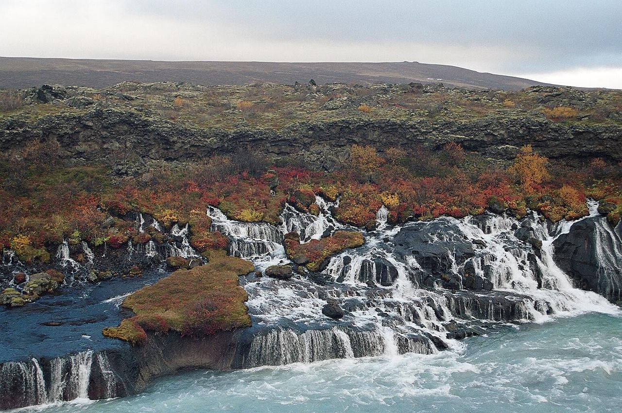
DirectionsHraunfossar
Why go
A series of waterfalls streaming for about 900 metres out of the Hallmundarhraun lava field and pouring into the Hvítá. Wikipedia
Getting there
DirectionsSeljalandsfoss
Why go
Right by Route 1 in the South Region, this 60 m waterfall is fed by a river rising from the Eyjafjallajökull glacier. Wikipedia
Getting there
Directions- +26 more on the full mapEvery one pinned with a note in the Waterfalls layer.



Hot Springs & Pools in Iceland
3 of 30Geysir
Why go
The Great Geysir gave the English word geyser its name, and geological studies suggest it began forming about 1150 CE. Wikipedia
Getting there
DirectionsHveravellir
Why go
A geothermal field in the north of the Langjökull glacier, part of the Oddnýjarhnjúkur-Langjökull volcanic system. Wikipedia
Getting there
Directions- Hot Springs & Pools
Blue Lagoon
Why go
A geothermal spa set in a lava field on the Reykjanes Peninsula, 5 km from Grindavík, in front of Mount Þorbjörn. Wikipedia
Getting there
Directions - +27 more on the full mapEvery one pinned with a note in the Hot Springs & Pools layer.


This guide shows 16. The map has 146.
Every place in this guide plus 130 more, colour-coded by layer and ready to navigate in Google Maps.
Viewpoints in Iceland
1 of 30Fjaðrárgljúfur
Why go
The 'feather river canyon' in south east Iceland, with steep walls and the Fjaðrá river winding through it. Wikipedia
Getting there
Directions- +29 more on the full mapEvery one pinned with a note in the Viewpoints layer.

Glaciers & Ice in Iceland
5 of 19Sólheimajökull
Why go
An outlet glacier between Katla and Eyjafjallajökull, popular with visitors for its size and relative ease of access. Wikipedia
Getting there
DirectionsSnæfellsjökull
Why go
A 700,000-year-old glacier-capped stratovolcano on the westernmost part of Snæfellsnes, sometimes seen from Reykjavík 120 km away. Wikipedia
Getting there
DirectionsEyjafjallajökull
Why go
One of Iceland's smaller ice caps, north of Skógar, covering a volcanic caldera with a summit elevation of 1,651 metres. Wikipedia
Getting there
Directions- Glaciers & Ice
Langjökull
Why go
Iceland's second largest ice cap at 870 km2, covering the higher parts of its volcanic system and clearly visible from Haukadalur. Wikipedia
Getting there
Directions - Glaciers & Ice
Breiðamerkurjökull
Why go
A tongue of Vatnajökull that ends in two lagoons, the famous Jökulsárlón and the smaller, less known Breiðárlón. Wikipedia
Getting there
Directions - +14 more on the full mapEvery one pinned with a note in the Glaciers & Ice layer.


Food & Drink in Iceland
1 of 35Tjöruhúsið
Why go
A seafood restaurant in Ísafjörður, housed in Neðstikaupstaður, the oldest cluster of houses in Iceland. Wikipedia
Getting there
Directions- +34 more on the full mapEvery one pinned with a note in the Food & Drink layer.

Every pin on one map
Tap an open pin to see it. The rest unlock with the full map.
All 146 places on one map
Open it in Google Maps on your phone, see what is near you and navigate in one tap. Instant download.
- Waterfalls32
- Hot Springs & Pools30
- Viewpoints30
- Glaciers & Ice19
- Food & Drink35
Why-go notes are adapted from the linked Wikipedia articles by their contributors and are available under CC BY-SA 4.0. Photos are from Wikimedia Commons, credited on each photo with its author and licence.